Unrealized "natural borders" and their consequences

An obvious natural border would be the whole of Great Britain + Ireland. Maybe if the Anglo-Saxons do even better than IOTL they could occupy the whole of Britain, and subsequently launch a successful invasion of Ireland as well? The most obvious consequence would be a more culturally homogenous British Isles; also, if such a state got involved in any sort of Hundred Years' War analogue, it would no doubt do better than IOTL, both because of its extra wealth and manpower and because it wouldn't have to worry about getting invade by Scotland while most of the army is away fighting in France.
Ironically I can see a unified Britannia being less involved in continental geopolitics, in the same way Japan was more or less insulated from continental East Asian politics. Though I am aware the English Channel is a smaller barrier than the Sea of Japan.
 
Some kind of Thracian or later Bulgar kingdom encompassing the entire lower Danube, or maybe Russian expansion down to the Thracian mountains.

Also the lower Mekong basin is split between Cambodia, Laos, Vietnam, and Thailand, which is kinda weird just in geographic terms.
 
Also the lower Mekong basin is split between Cambodia, Laos, Vietnam, and Thailand, which is kinda weird just in geographic terms.
A lot of weird borders in Africa, Asia, and the Americas in particular can be chalked to some form of colonialism I find.

Like the weird Central Asian borders (including the much memed about Russian-Kazakh border and the Uzbekistan enclaves) can be put on the shoulders of the Soviets.
 
A lot of weird borders in Africa, Asia, and the Americas in particular can be chalked to some form of colonialism I find.

Like the weird Central Asian borders (including the much memed about Russian-Kazakh border and the Uzbekistan enclaves) can be put on the shoulders of the Soviets.

Plus for whatever reason the Soviets decided to give Samarkand and Bukhara to Uzbekistan instead of Tajikistan.
 
With the obvious caveat that Slovaks and Romanians wouldn't be so happy about it.

Speaking of Romania, the natural northeast border would be at the Dniester, and they already have the Danube to the south.
That’s a common caveat with this whole ‘Natural Borders’ concept. The French desired Rhine border wasn’t something the Dutch and Germans* were happy about. (*= though for centuries they were hopelessly divided)

In Hungary’s defence, that were the historical borders of the kingdom of Hungary, and they do come close to the definition in terms of being defensible.
Of course different nationalities have different and often conflicting ideas about this concept.
Like how the Dutch viewed the French idea regarding the ‘Natural Border’ of France; or how Slovakians and Romanians viewed this with respect to Hungary.
 
I'd argue that he "natural borders" of the United States would be the 1848 U.S. borders plus Canada and Alaska. Maybe/maybe not Hawaii.
 
A natural border for the US in the East with Canada would be the St. Lawrence river, maybe accomplished with a more successful campaign in Canada during the Revolutionary War? The butterflies would be interesting, especially as to how the rest of the Revolutionary war would go, and if the US would far better at taking Canada when/if a War of 1812 like situation erupts.
 
A natural border for the US in the East with Canada would be the St. Lawrence river, maybe accomplished with a more successful campaign in Canada during the Revolutionary War? The butterflies would be interesting, especially as to how the rest of the Revolutionary war would go, and if the US would far better at taking Canada when/if a War of 1812 like situation erupts.

The St. Lawrence being the border would be horrible for the economic life on both banks - it's like controlling the Hudson or the Nile, the rivers are such a vital travel route for a hemmed-in river valley you kill the livelihood and standard of living of everyone controlling a single half of it and forcing potential closings, tolls, warfare, etc. on it. Not to mention tons of angry Quebeckers within the American-controlled southern bank.

I'd argue the Appalachian mountains hitting their natural end at the Gulf of St. Lawrence, in effect taking the Maritime provinces, are better. America will control the entire crest of that mountain range, and as a bonus take in the Maritimes, which historically had plenty of colonial direct-American settlement (New England Planter and Loyalist alike) and are primarily Anglo in language and overall culture. No pesky French Canadians, (whose pathway to the wider world via the St. Lawrence Gulf is contested by now-American Cape Breton) only a handful of pesky French Acadians in New Brunswick's north, and that's no worse than those French-speakers already existing in northernmost Maine and Vermont! :p

I'd argue that he "natural borders" of the United States would be the 1848 U.S. borders plus Canada and Alaska. Maybe/maybe not Hawaii.

Definitely agree with the "if you're going west of the Rockies you go all the way to the Pacific" and "Gila and Rio Grande River" bits, since it's easier to access the American west from east of the Rockies than from northern Mexico with the killer Wild Horse, Chihuahua, and Navajo Deserts in the way and those rivers being more or less within said deserts to become as useful an international border as any. Quebec is still Gallic in ethnocultural terms if that's an issue, but other than that if you control the entireity of the Great Lakes watershed and Great Plains, then your only opponents would be nomadic hunter-gatherers in the far Canadian north, so to speak.
 
The St. Lawrence being the border would be horrible for the economic life on both banks - it's like controlling the Hudson or the Nile, the rivers are such a vital travel route for a hemmed-in river valley you kill the livelihood and standard of living of everyone controlling a single half of it and forcing potential closings, tolls, warfare, etc. on it. Not to mention tons of angry Quebeckers within the American-controlled southern bank.

I understand how life for the Canadians on their side of the river would be worse than OTL, but how would giving the US the South Bank harm the Americans as opposed to OTL? Wouldn't in this situation America at least be able to contest river access, rather than being forced to cede all of it to the British? I agree it would cause a lot of tension since the inevitable connection will be made to the Great Lakes, which is one reason I think it would be an interesting POD.

There's also the question of what the Quebeckers would do in this scenario after the war, either flee north like OTL loyalists, or stay and be a thorn in the republic's side. I can imagine that discrimination against these Catholics would be even more than that of the Loyalists, so many would probably migrate to the north bank of the river.

It wouldn't harm the Americans per se for sure - but it would still be annexing a very big batch of people considering themselves alien to America and vice-versa, and I could see the free and occupied Quebeckers alike causing enough issues on a very regular basis, that the idea of the Erie Canal in entirely American territory filled with regular Anglo-Americans seems like a mighty good deal for the sake of peaceful travel (not to mention it's entirely ice-free all year, every year, unlike the St. Lawrence can be in various bits of it). Otherwise anyone fleeing north is just going to rile up free Quebec to take back its integral land so it can protect itself since Americans can merely cross the river - which could mean INVADING - any time they feel like it with excessive ease to the big cities of Quebec City, Three Rivers, and Montreal. Same reason that Simcoe wanted to move Upper Canada's capital from Kingston on the St. Lawrence to London, ON and it eventually settled on Toronto. I can see the appeal of the border on the map for sure, but the Appalachians are probably a much better natural border and America can de-facto control Quebec anyway via holding Cape Breton and entry in and out of the Gulf of St. Lawrence.

Think of it this way - Spain threatening to close the Mississippi River via controlling the western half of it in the 1780s led to Pinckney's Treaty in order to secure America's then-western flank, and the much more powerful France taking Louisiana over in 1803 caused Jefferson to consider allying with Britain to take control of the entire watershed for the sake of security. Controlling only half of the river is as much do-or-die for the Quebeckers in terms of their sense of safety and independence. The St. Lawrence River valley's natural borders, and thus Quebec's by extension itself, are basically the Hudson Bay watershed and Appalachian mountains.
 
Italy is very close, with just some adjustment to the border with Slovenia to make it complete.
I'm not really a believer in 'natural borders' as a thing but presumably for Italy (if they were a thing) they would include the Po watershed which is basically Italian speaking Switzerland. Also, the Eastern border with France below the Po watershed (basically the Nice area) looks slightly off if we are thinking of natural boundaries. Not to mention the failure to include Corsica or Malta. It certainly doesn't look natural to include Sardinia but not Corsica. Or to include Lampedusa but not Malta. Plus Italy has two enclaves, San Marino and Vatican City. Presumably they would be within Italy's natural borders too.

I mean, definitely when you look at Trentino-Alto Adige/Südtirol we can see the effects of the theory of natural borders in place, but that doesn't mean that Italy is a border adjustment in Slovenia to complete the effect.

Thinking historically a country that appears to have done a good job of using geography and defensibility to "complete" their borders would be Czechia/Czech Republic. 100 years ago their border areas were German majority (Sudetenland). Then we had WWII and millions died and the Germans were moved out of the area and today the country has a solid defensible border and is ethnically homogenous. I guess that would be my candidate for the best example in Europe but again, not sure I really see it that way.
 

Skallagrim

Banned
Here are my personal interpretations of the "natural" borders for Germany, Austria, France, Italy, the Netherlands, Belgium and Luxembourg. Note that these proposals are not aimed at creating countries that would magically have a homogeneous population. In fact, there are cases where parts of the national populace are left outside the borders. The goal here is to depict borders that would create the most territorially cohesive, defensible countries. There are situations in OTL where I believe certain countries actually hold more land than would be ideal for that purpose.

natural borders.png


Some notes:

-- We see the Carolingian inheritance reflected here. This is to be expected, but it's even more strikingly clear than one might expect.

-- The area of Germany that I believe the Netherlands should claim in this context has significant correspondence to the historical Low German area. Similarly, the area that Austria should claim has significant correspondence to the historical Upper German area. The region in between, similarly, greatly reflects the Middle German area. Even without attempting to create divisions along those lines, we see them pop up anyway. Geography isn't destiny, but it sure does stack the deck!

-- The most heavily contested regions, seen together, greatly resemble Lotharingia. Despite the fact that the Middle Kingdom ceased to exist while France and Germany coalesced, it remains visible as the proverbial (and occasionally literal!) no man's land where the strategic interests of France and Germany both overlap and clash with one another.

-- The topographic basemap is is not mine, and comes from over yonder in the Q-bam thread.
 
Last edited:

Maetel

Banned
Dnyeper_Basin_Magyar - Edited.png


Belarus' border would be advantageously extended to correspond with the the Desna river and the Upper Dniepr. This would significantly reinforce the southeastern border with Russia. The country is already in a good position nestled beneath the Smolensk Upland on its northeastern frontier. With the Dniepr-Desna border it would have its own foothold in the highlands. It would contain South Smolensk and the two rivers form a rhomboid natural defensive line on the other half of the Belarus-Russia front. A truly wonderful border for a wanked Belarus is the Dniepr-Desna frontier extended to encompass the upper Seym and Psel watersheds. In the southwest the border could also be affixed to the upper Pripyat river.
 
Last edited:
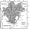
Brazil's southern "natural borders" depend if you consider either the River Uruguay or the Paraná-Paraguay Rivers as the natural frontier.
If its the former then Brazil would only have to annex Uruguay, with once belonged to it as the Cisplatina province in the times of the United Kingdom of Brazil and Portugal and the Empire of Brazil.
If its the latter, however, Brazil will have to annex, in addition to Uruguay, the Argentine provinces of Missiones, Corrientes and Entre Rios, as well as half of Paraguay.F1.large.jpgKL31773.jpg
As for the rest I honestly don't know. Maybe try to contain the Amazon Forest wholly inside its borders? But that would require parts of Bolivia, Peru, Ecuador, Colombia, Venezuela, and the all the Guyanas(Guyana, Suriname and French Guiana).
Or perhaps achieve a connection with the Pacific ?

Either way, the consequences of the Southern natural borders would be the erasure of Uruguay and the permanent enmity of Paraguay and Argentina.
The consequences of the second one, that of the Amazon Forest belonging wholly to Brazil, would mean open war with the rest of the countries of South America, with the exception of Chile.
Perhaps I am being overtly ambitious on the Northern-Western border, but I genuinely don't know what would be Brazil's "natural borders" in that direction.
 
What are the ideal borders for Iran? I would imagine they probably want all of the South Caucasus + North Ossetia.

Depends on how far back you go and what ends up becoming Iranian by the end of it. Today's Iran is IMO pretty close to those ideal borders all things considered but there's always more lands that would have helped ensure the greater security of the core Iranian lands. I think a powerful Iran would want control of the entire Persian Gulf to assure military supremacy in the region, with full control of the Omani highlands as its southern border. While we're at it, you want to control the critical mountain passes between India and Iran too. For the west and the north the current borders are okay, but the more of the Caucausus mountains you control the better your defense position is a general rule of thumb. But as far as the Levant goes, eh, not all that defensible barring Persiawank borders. Finally Central Asia is a wild card; I think you could legitimately make the case that bar a few border adjustments, OTL's Iranian border is a pretty decent defensive border for its north.

Early PoD Persiawank natural borders would be something along the lines of OTL Persia, the full Caucasus Mountains, all of Arabia and the Levant up to or including the Sinai Peninsula, and all lands up to the western banks of the Indus in the east. Plus control of strategic Indian Ocean islands such as Socotra, the Seychelles, etc. Central Asia and Anatolia are the two wild cards where there's much to gain but more to expose and it's hard to say where the best place to stop is. I think the conservative choice for Anatolia is the Cilician Gates, and for Central Asia, beats me. Maybe Aqtau as a military fort to the Aral Sea to the southern banks of the Syr Darya?
 
Top