Map Thread XXII

View attachment 902834
View attachment 902835
View attachment 902836
View attachment 902837
View attachment 902838
View attachment 902839
View attachment 902840

A timeline of the Americas durring the Century of Revolutions (with the bottommost map being one of the Modern Day)
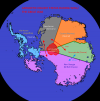
Like @WheelyWheelyLegsNoFeely said the thick borders are jarring but I think most of the mappers on this forum (at least many, myself included) probably have made the same mistake, it's just part of the learning process with Worlda maps.
As far as the layout of the countries goes though I actually like this a lot, it's refreshing to see a take on colonial and especially post-colonial borders that diverges so heavily from the norm while still being (I think) fairly plausible.
 
1713898493508.png
Is... is that Norwegian Bjarmaland?
 

mr morbius

Kicked
Is Spain suzerain over Algeria, Tunisia and Libya?
Yes, since France is occupied (and most likely won't be back for another few decades due to the Cold War) Iberia (which is just really Spain and their 2 pimps in Portugal) occupies this land.

Is... is that Norwegian Bjarmaland?
No, that's the North Russian Free State - a joint occupation of various European Powers, mostly Western ones. Norway is, however, one of them, even if their contribution is mostly symbolic - a few token brigades of volounteers and a handful of outdated planes.
 
Yes, since France is occupied (and most likely won't be back for another few decades due to the Cold War) Iberia (which is just really Spain and their 2 pimps in Portugal) occupies this land.


No, that's the North Russian Free State - a joint occupation of various European Powers, mostly Western ones. Norway is, however, one of them, even if their contribution is mostly symbolic - a few token brigades of volounteers and a handful of outdated planes.
How goes this suzerainty? Better than the French or are the Iberians a new breed of the same thing?
 

mr morbius

Kicked
How goes this suzerainty? Better than the French or are the Iberians a new breed of the same thing?
Depends. Lybia has limited self-governance, Tunesia and Algeria are slightly better off, as while French colonization was replaced by Iberian colonization the Iberians have begun an active campaign to improve the lives of locals (More schooling, Infrastructure Expansion etc.). Meanwhile Morroco is being activly and brutaly ,,Iberianized" with stragglers thrown south into the now-anarchic Sahara.
 

mr morbius

Kicked
Here's my Alternate Race for Africa. It started out as ,,Race for Africa but it's slightly better for Africans" but looking back I'm not so sure that's the case.

1714038594802.png

Mostly complete aside from the South Sahara area
 
Indeed but also more intriguing, what the heck is all the grey?
Neutral countries, from the key. I thought it was weird that rump Prussia owned Tunisia until I realized it was just shading for countries that didn’t matter to either the global stage or to a particular world conflict.
 
Map i made of an RPG/TL Idea where less water results in the same sea level, but antarctica being only partially glaciated, causing Antarctica to be colonized in the 1800s (though i haven't decided if there are indigenous Antarcticans, rest assured if they are they will not be like the Tsalal (Fun fact: i haven't read Green Antarctica for the sake of not being traumatized), more like snow Polynesians and/or Fuegans who went too far south), only for it to fall into chaos the second WW1 breaks out. First is Colonies, Second is during WW1 (With neutral Colonies around the south pole declaring mutiny) and ice cover map (with south pole marked)
EDIT: Changed the name of the German Colony to an actually German name that means "New Silesia"
Colonies.png


Colonies WW1.png
Map.png
 

Attachments

  • Colonies WW1.png
    Colonies WW1.png
    25.1 KB · Views: 214
  • Colonies.png
    Colonies.png
    22.6 KB · Views: 227
Last edited:

mr morbius

Kicked
1714061636900.png

The World in ,,A Turn North" in what we would call 9 BC, split between the Empire of Carthage (centered in OTL Crimea), the Roman Empire (Capital buildt in OTL Helesinki), The State of Gaul (which was never crushed by Romans ITTL for obvious reasons... at least not yet), the ,,Greek" City States in North Africa (and their colonies) and finaly, the Vandalian Republic in OTL Southern Poland.
 
Map i made of an RPG/TL Idea where less water results in the same sea level, but antarctica being only partially glaciated, causing Antarctica to be colonized in the 1800s (though i haven't decided if there are indigenous Antarcticans, rest assured if they are they will not be like the Tsalal, more like snow Polynesians and/or Fuegans who went too far south), only for it to fall into chaos the second WW1 breaks out. First is Colonies, Second is during WW1 (With neutral Colonies around the south pole declaring mutiny) and ice cover map (with south pole marked)
View attachment 903020

View attachment 903019View attachment 903021
Shout out the OG Tsalal! Only true fans remember.
 

mr morbius

Kicked
The borders don't make much sense. You should consider taking into account geographic features like mountains, ecosystems, and drainage basins when constructing borders, as well as roads or routes of migration when constructing possible polities.
I tried to make ,,Peru" a sort of Traders' Republic that follows the Amazon, but yeah I guess you have a point with everything else.
 
I tried to make ,,Peru" a sort of Traders' Republic that follows the Amazon, but yeah I guess you have a point with everything else.
That's fine but it begs the question of exactly what is being traded with whom and why the river is helpful to that end. It also begs the question of how this Peruvian society (who are they?) traversed the Andes and found themselves in the best position to conquer/expand downriver as opposed to other polities and peoples in the Amazon basin. That then begs further questions about what their society is like (is power centered on the eastern or western side of the Andes?) how their economy is built (is this a terra preta society? Do they grow quinoa? Is river power utilized for mills and such?) what their culture is like (is there any form of common religion or worship? How similar are they to OTL societies?) and so on and so forth. The more you consider these sorts of questions, sensible boundaries and political structures in any given scenario will start to become more obvious.
 
Red Man's Burden - What if Europe was the backwater while the Americas developed faster?

View attachment 903088
My man, while I love seeing people being enthusiastic about maps, you are borderline spamming the thread. I'd suggest you wait a bit between posts and then make one big post every few days compiling all maps. Furthermore, I'd say that while some of your ideas are very interesting, they could benefit from a bit more time thinking the scenarios out and mapping them more thoroughly, and thus spacing out your posts could be an excellent chance to spend a bit more time on each map.
 
Top